A short look back in history
Gumri has been inhabited since ancient times. The present town dates back to the Russian fortress founded in 1837. Until the First World War it was the capital of a Ujesd in the Yerevan governorate. In the Russian Empire Gumri was called Alexandropol from 1840 to 1924, then, it was one of the largest cities of Russian-ruled Eastern Armenia with a population similar to that of Yerevan. Later the city was named after Vladimir Ilyich Lenin, Leninakan from 1924 to 1991; after the collapse of the Soviet Union in was named Kumajri in the years between 1991 and 1991/1992.

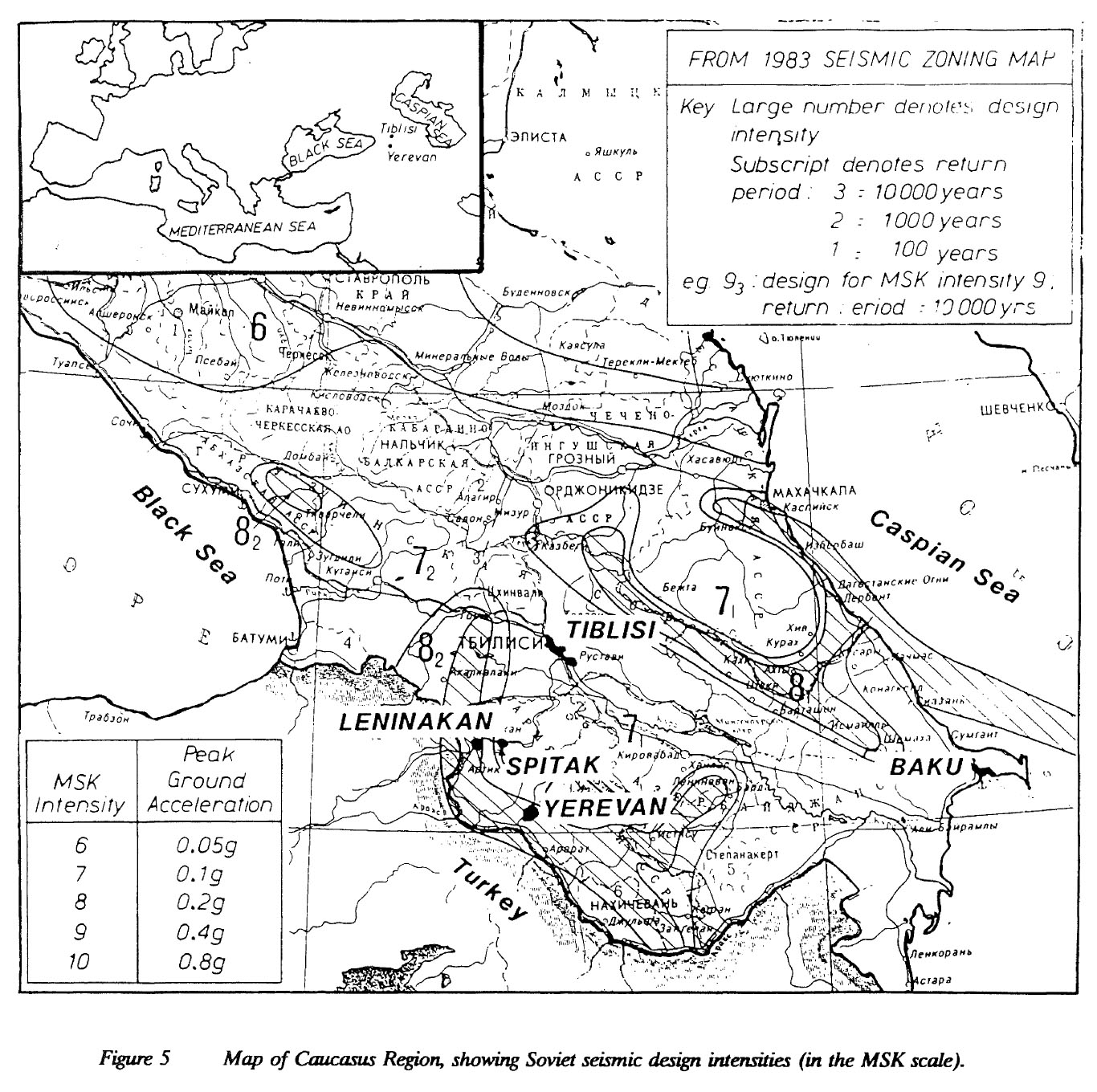

Maps showing the dimension of the 1988 earthquake (Wood et. al. 1993)
1988 Armenian earthquake
The 1988 earthquake that struck its epicentre in the area around the northern Armenian town of Spitak (now Lori Province) in the then Armenian SSR of the Soviet Union on 7 December 1988 is one of the most severe earthquakes of recent decades. With an estimated number of at least 25,000 dead and up to one million homeless, it also made it clear that the Soviet Union was economically at the end of its rope. As a result, the first humanitarian relief operations by Western organisations in the Soviet Union took place during the Cold War.
Gyumri, once a bustling city in Shirak province, Armenia, boasted a population of nearly 225,000 people. The economy was strong, powered by robust factories specializing in textiles, food processing, light industry, and machine building. These factories were what made Gyumri a primary industrial center in the former Soviet Union. On December 7, 1988 this Gyumri ceased to exist. An earthquake with a magnitude of 6.3 struck the region killing tens of thousands of people and injuring 130,000. This all happened in less than 1 minute. Shortly after, an aftershock of 5.3 magnitude destroyed the city even further. In Gyumri, 62% of buildings which stood higher than 4 stories were destroyed. This left 25,000 homeless. To house the people who lost their homes, the government quickly built what were meant to be temporary shelters. Till today, 2,500 families are still living in these makeshift homes which tend to lack basic needs such as water, electricity, and gas.
Gumri Hope Project (2008)


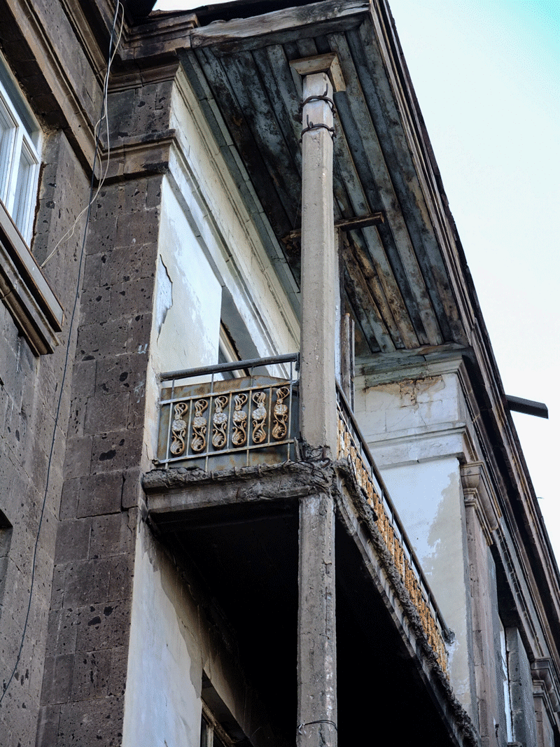
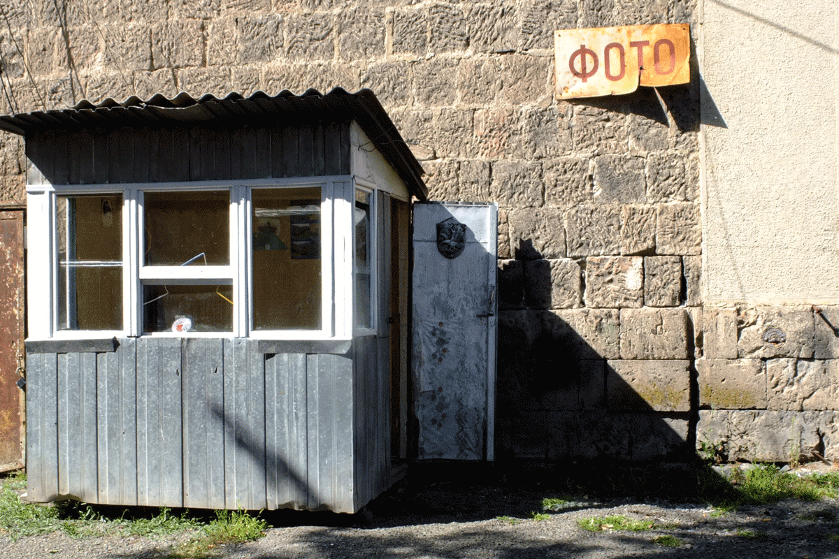
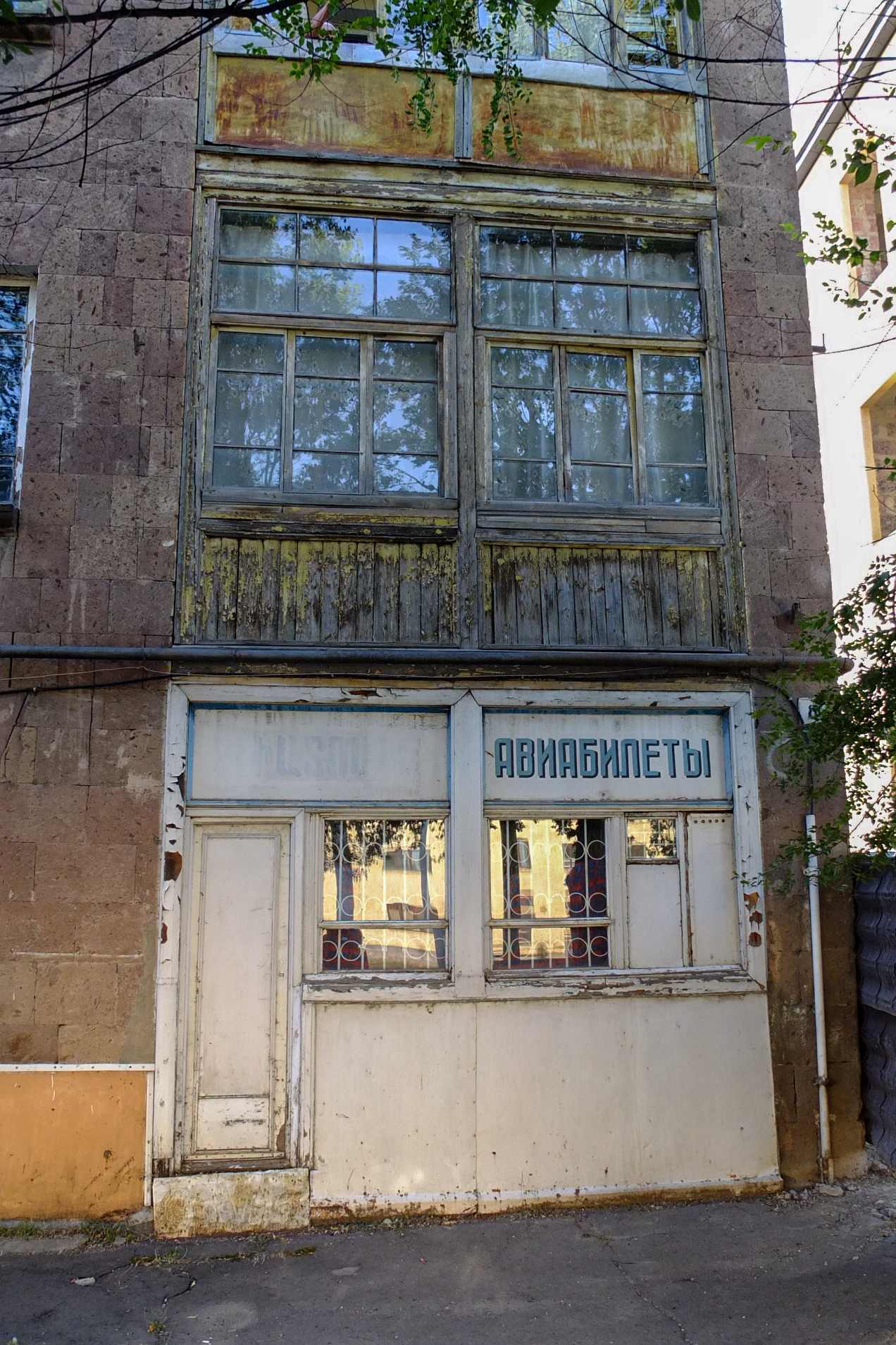
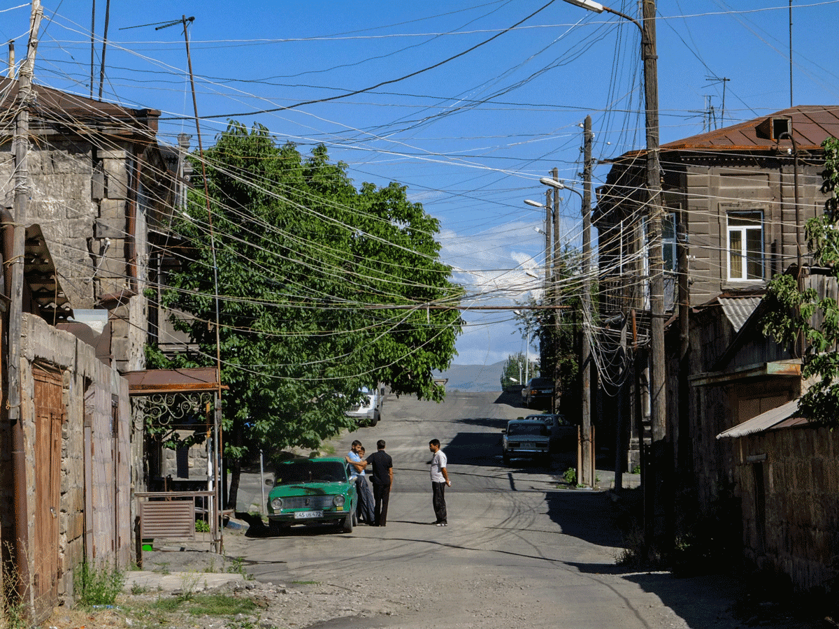
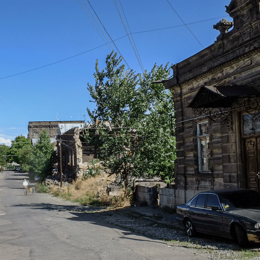
The Kumayri district
The Kumayri district is located in the centre of the city of Gyumri. Although some remains of the ancient city have been preserved, most of the historic buildings date from the 19th and 20th centuries. They reflect the development of the urban landscape from the Alexandrapol phase (1837-1924) over the period from 1924 to 1990, when the city was part of the Soviet Union.

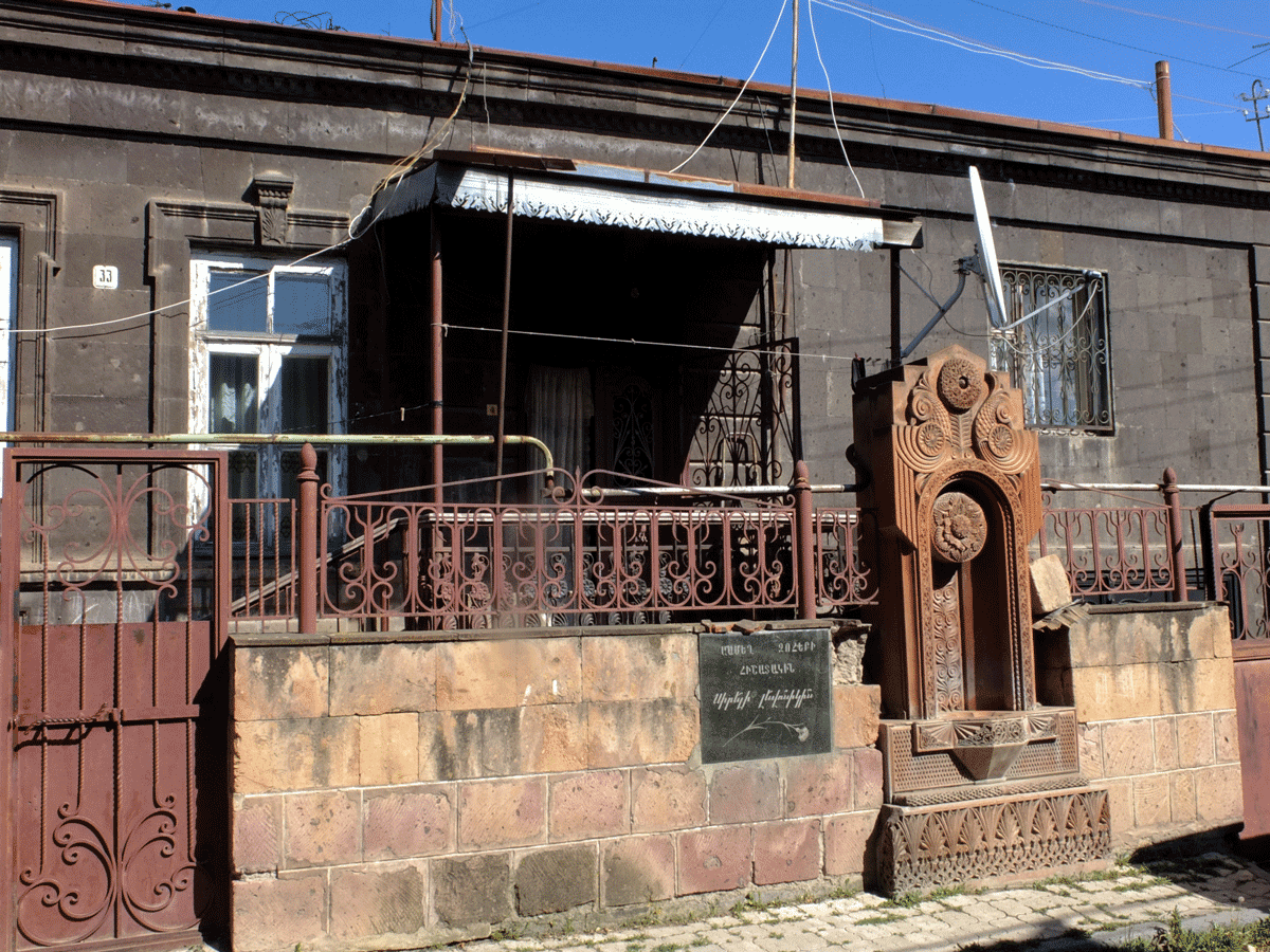
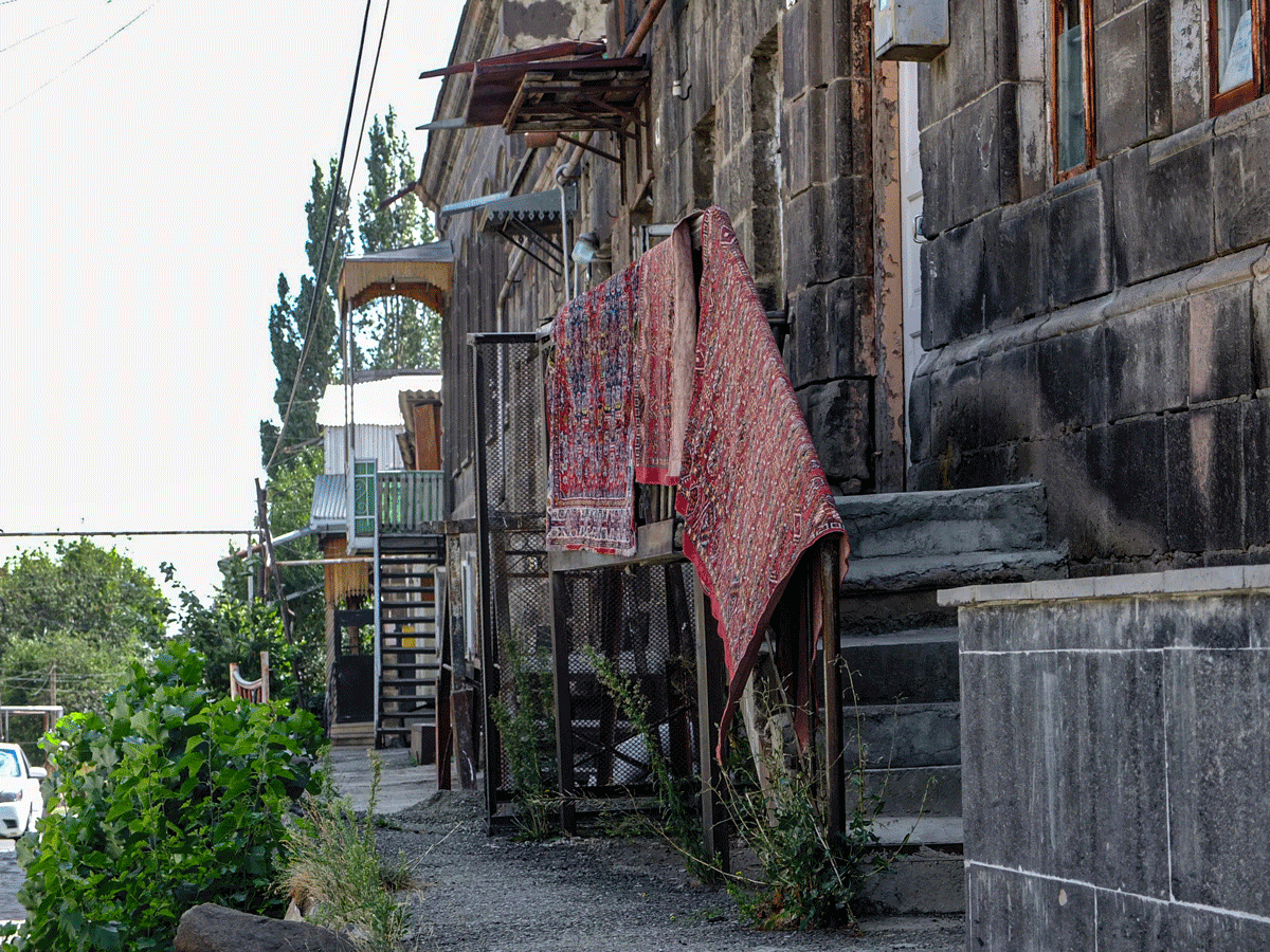


The Kumayri district covers 1,000 hectares and contains some 1,600 buildings and monuments. These buildings range from neoclassical buildings, which were built as part of 19th century urban development plans, to modernist high-rise structures from the Soviet era, designed as part of a programme aimed at creating huge boulevards and city squares.


Sovier era traces in the built space of Gyumriy
The monuments vary from the forbidden Sev Ghul Fortress – a remnant from the Russian-Turkish War – to opulent late 19th century buildings such as the Paris Hotel, which was used as a maternity clinic during the Soviet period. During the severe earthquake of 1988, about 80 percent of the buildings in Gyumri were destroyed. The political instability and economic difficulties in the period following Armenia’s independence increased the damage and worsened the social situation. Unemployment, political corruption and limited financial resources have led to historic buildings being abandoned, misused and structures that are unsuitable from a heritage conservation perspective being erected.
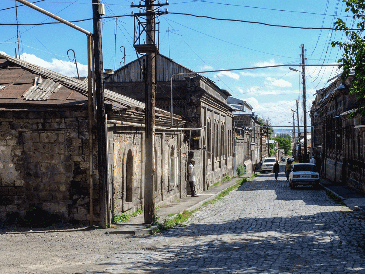

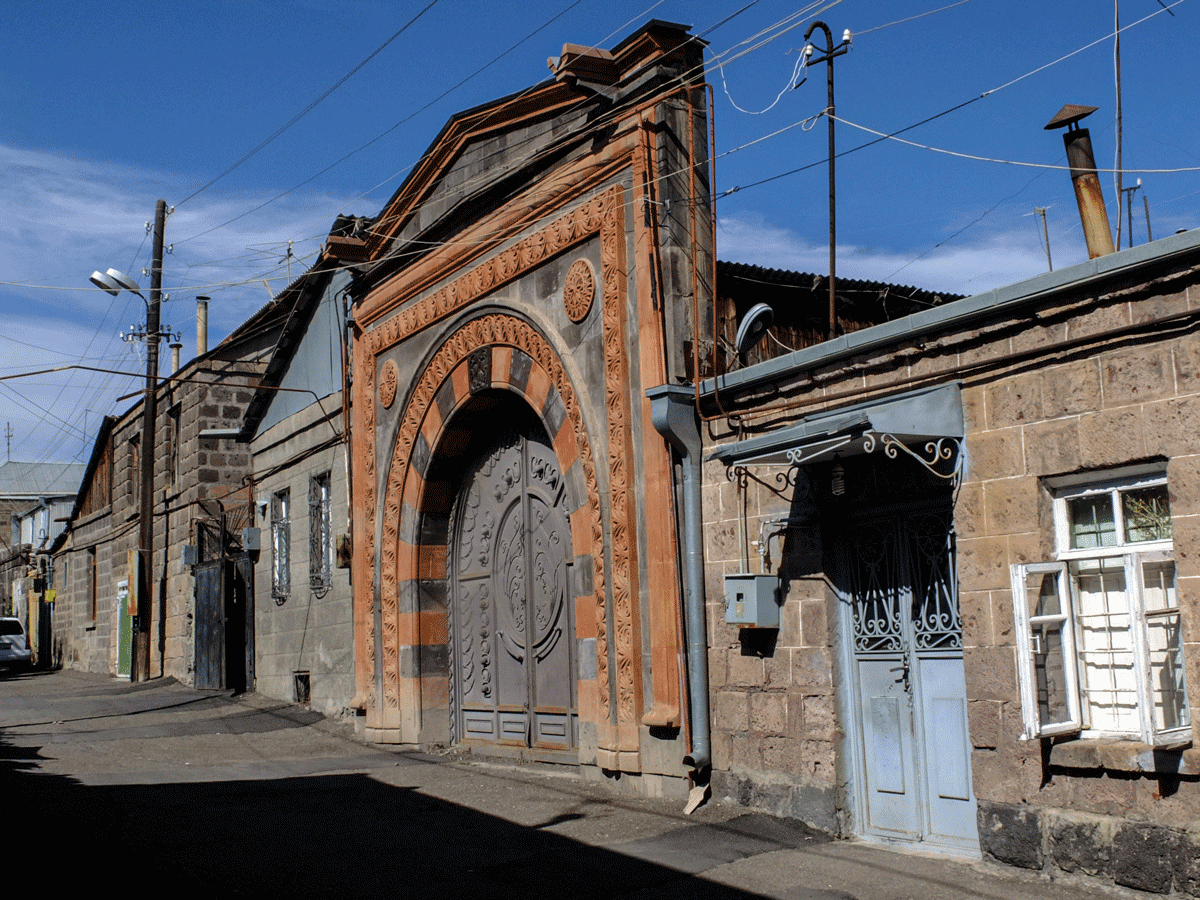
Except for the churches, the buildings in the old town are privately owned and are being sold, redesigned and destroyed without regard for the protection of historical monuments. As Gyumri has increasingly developed into an economic centre in Armenia, the pressure for development, the lack of legal provisions for the protection of cultural heritage and the lack of trained experts for the protection of historical monuments in this area together pose a threat to the historical fabric of the city.


The Holy Saviour’s Church after the earthquake and in the reconstructed state (2016)
Text: Stefan Applis (2020)
Photography: Stefan Applis (2016)
References:
Rehabilitation of Historic District located within Gorky-Abovyan-Rustaveli-Varpetats streets in Gyumri. Feasibility Study. https://rm.coe.int/gyumri-armenia-comus-fs2-rehabilitation-of-historic-district-located-w/1680710596
Community-led Urban Strategies in Historic Towns (COMUS) (Ed.). Gumri Project Hope (2008). http://www.gyumriprojecthope.org/gyumri/
Wood, P. R., Berrill, J. B., Gillon, N. R. & North, P. J. (1993). Earthquake of 7 December 1988, Spitak, Armenia Report of the NZNSEE Team vistit of 1989. Bullatin of the New Zealand National Society for Earthquake Engeneering. Vol. 26, No. 3. http://www.nzsee.org.nz/db/Bulletin/Archive/26%283%290253.pdf
